
Anúncios
Waze has revolutionized the way millions of drivers navigate daily, offering intelligent routes that adapt in real-time to traffic conditions and road events.


Whether you’re commuting to work, heading out on a road trip, or simply trying to avoid that dreaded rush hour traffic, Waze’s routing algorithms work tirelessly behind the scenes to get you there faster. The app’s community-driven approach means that every piece of data—from accidents to speed traps—feeds into creating the most efficient path possible.
Anúncios
Understanding how Waze calculates and suggests routes can transform your driving experience from stressful to seamless. Let’s dive deep into what makes Waze’s routing system exceptional and how you can leverage its features to consistently choose the best possible trajectory for your journeys. 🚗
How Waze Determines the Best Route for Your Journey

Waze employs a sophisticated algorithm that goes far beyond simple distance calculations. Unlike traditional GPS systems that might suggest the shortest route by mileage, Waze prioritizes time efficiency above all else. The app continuously analyzes real-time traffic data collected from millions of active users simultaneously navigating roads worldwide.
Anúncios
When you enter a destination, Waze’s servers process multiple potential routes instantly. The algorithm considers current traffic speeds, historical traffic patterns for that specific time and day, reported incidents like accidents or construction, road types, and even weather conditions in some regions. This multifaceted approach ensures that the route you receive isn’t just theoretically fast—it’s practically optimized for right now.
The beauty of Waze lies in its dynamic recalculation capability. If traffic suddenly builds up ahead or a new accident gets reported on your current path, Waze will proactively suggest alternative routes. You’ll receive a notification asking if you want to switch to a route that could save you precious minutes, complete with the estimated time difference. This flexibility means you’re never locked into a suboptimal trajectory.
The Role of Community Reports in Route Optimization 📱
One of Waze’s most distinctive features is its crowdsourced information network. Every time a Waze user reports a hazard, police presence, traffic jam, or road closure, that data becomes immediately available to all nearby drivers. This collective intelligence creates a constantly updated map that reflects actual road conditions far more accurately than any automated system could achieve alone.
When calculating your route, Waze weighs these community reports heavily. A road that appears clear on satellite imagery might actually be experiencing severe congestion, and Waze will route you around it based on user reports. Similarly, if multiple drivers report smooth sailing on a typically congested highway, Waze might suggest that route over alternatives that would normally be faster.
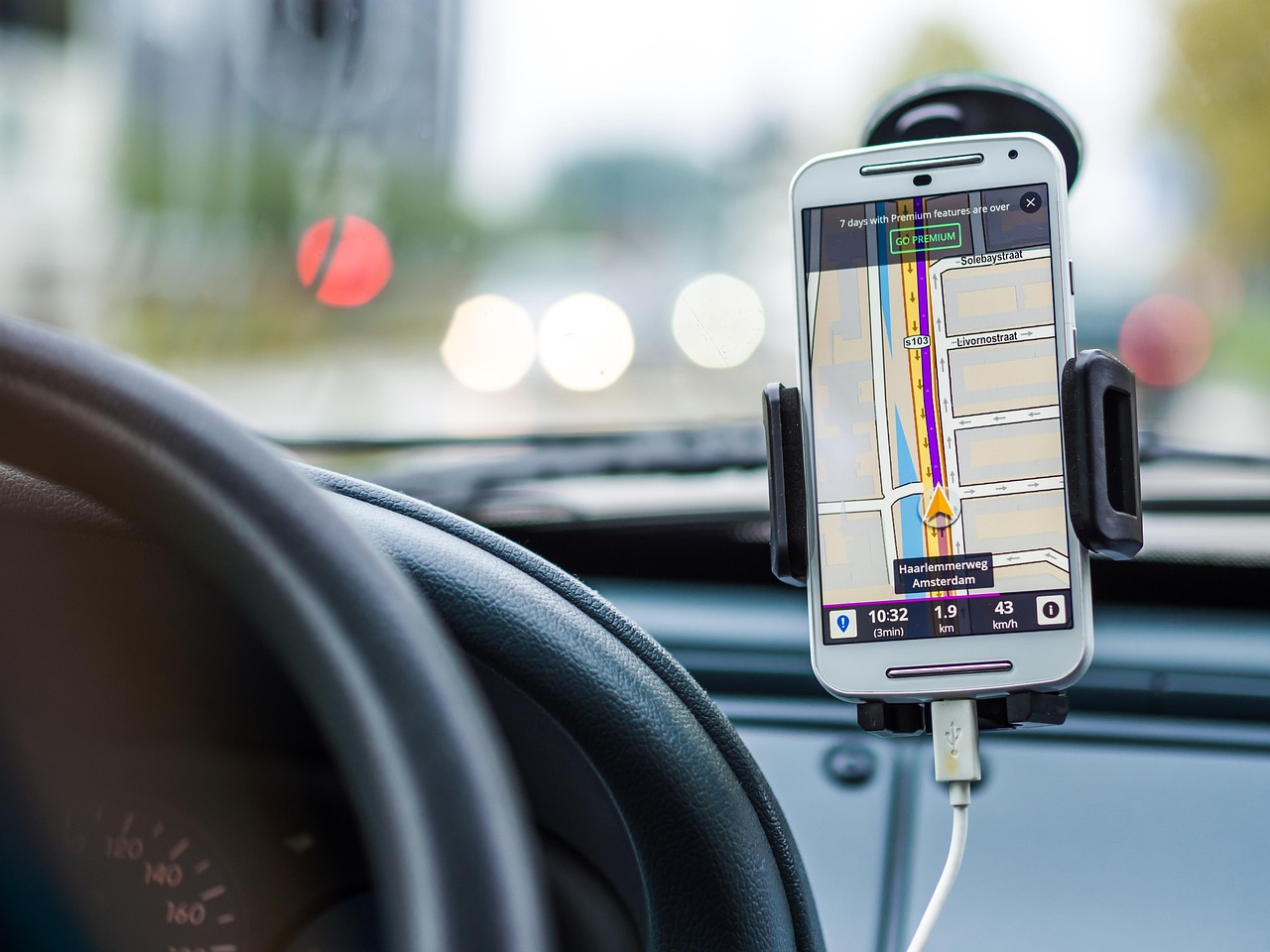
Understanding Different Route Options Waze Presents
When you start navigation, Waze typically presents you with up to three different route options, each with specific characteristics. The primary route—usually highlighted in blue—represents what Waze calculates as the absolute fastest option based on current conditions. Alternative routes appear in gray and might save or cost you a few minutes compared to the primary suggestion.
These alternatives exist for good reason. Sometimes the “fastest” route involves complex navigation through residential areas or numerous turns that some drivers might find stressful. An alternative might take two minutes longer but keep you on major roads with simpler navigation. Waze gives you the choice to prioritize what matters most to you: pure speed or driving comfort.
Pay attention to the estimated arrival times for each route option. Waze updates these continuously, so if you’re sitting in your driveway contemplating which path to take, waiting 30 seconds might reveal that traffic patterns have shifted enough to make a different route preferable. This real-time updating continues throughout your journey, ensuring you’re always working with the freshest data available.
When to Choose Alternative Routes Over the Primary Suggestion
While Waze’s primary route is usually your best bet, certain situations warrant choosing an alternative. If the fastest route involves toll roads and you’re trying to save money, check the alternatives—one might be toll-free with only a minimal time penalty. Similarly, if your fuel tank is running low, a route with fewer elevation changes or less stop-and-go traffic might actually be more efficient despite appearing slightly slower.
Experience with your local area also matters. Sometimes Waze might suggest cutting through a neighborhood you know has poorly maintained roads or confusing layouts. In these cases, trusting your local knowledge and selecting a more familiar alternative can reduce stress and potential navigation errors, even if the app promises a time savings.
Customizing Route Preferences for Better Results ⚙️
Waze offers several settings that directly impact the routes it calculates for you. Accessing these preferences allows you to tailor the app’s behavior to match your driving style and priorities. Navigate to Settings, then Navigation, and you’ll find options that can significantly alter your routing experience.
The “Avoid toll roads” setting is straightforward but powerful. Enabling this forces Waze to calculate routes that bypass any toll facilities, which can be particularly useful for daily commutes where toll fees would add up quickly over time. Keep in mind that avoiding tolls might add considerable time to longer journeys, so you might want to toggle this setting depending on the specific trip.
Similarly, “Avoid ferries” and “Avoid highways” options give you control over road types. Some drivers feel uncomfortable on high-speed interstates and prefer surface streets, even if they take longer. Others want to avoid the unpredictability and potential delays associated with ferry crossings. These preferences ensure Waze respects your comfort zone while still optimizing within those constraints.
The Dirt Roads and Difficult Intersections Settings
Hidden within Waze’s navigation settings is an option to “Avoid difficult intersections,” which can be invaluable for newer drivers or those unfamiliar with an area. When enabled, Waze will try to route you through intersections with traffic lights or clear right-of-way rules rather than complex uncontrolled intersections that require judgment calls about when to proceed.
The “Avoid unpaved roads” setting is another gem, especially relevant for road trips through rural areas. While that dirt road might technically shave five minutes off your journey, it could also leave your vehicle dusty or worse if weather conditions have made it muddy or rutted. Enabling this preference keeps you on paved surfaces, trading minor time increases for vehicle preservation and driving comfort.
How Waze Handles Long-Distance Routes Differently 🛣️
When you’re planning a journey that spans hundreds of miles, Waze adapts its routing strategy accordingly. For long trips, the app places greater emphasis on highway routing and sustained speed rather than the intricate neighborhood shortcuts it might suggest for shorter urban drives. This makes sense—saving two minutes on a five-hour drive by navigating through unfamiliar residential areas isn’t worth the added complexity.
Waze also considers fuel stops and rest breaks on longer routes, though this feature requires some user initiative. You can search for gas stations or restaurants along your route, and Waze will show options that minimize detour time. The app calculates how much additional time each stop will add, allowing you to make informed decisions about where to take breaks without derailing your schedule.
For multi-hour journeys, historical traffic data becomes increasingly important in Waze’s calculations. The app knows that traffic patterns change throughout the day, so it might route you through a city center that’s currently congested if it predicts you’ll arrive after rush hour has cleared. This predictive routing can save substantial time compared to apps that only consider current conditions.
Understanding ETA Accuracy on Extended Trips
Waze’s estimated time of arrival becomes progressively more accurate as you get closer to your destination. At the start of a long journey, the ETA is based heavily on assumptions about traffic conditions hours ahead. As you drive and those future conditions materialize into present reality, the estimate refines itself with actual data.
Don’t be alarmed if your ETA shifts by 10-15 minutes during the first hour of a long trip. This is normal recalibration as the app replaces predictions with observations. By the final hour of your journey, the ETA typically stabilizes and becomes remarkably accurate, often within 2-3 minutes of your actual arrival time.
The Impact of Waze’s Speed Limit Data on Routes
Waze incorporates speed limit information into its routing algorithms, though not always in obvious ways. The app knows the legal speed limit for virtually every road segment and factors this into travel time calculations. However, Waze also knows actual average speeds driven by users on those roads, which often differ from posted limits.
This dual awareness creates interesting routing dynamics. On highways where drivers typically exceed the speed limit, Waze’s time estimates reflect these real-world speeds rather than legal limits. Conversely, on roads where traffic calming measures or heavy enforcement keep actual speeds below posted limits, Waze adjusts expectations downward. This realism makes Waze’s ETAs more reliable than systems that naively assume everyone drives exactly at posted speeds.
The app also uses speed limit data to warn you when you’re driving faster than allowed. While this safety feature doesn’t directly impact routing, it can indirectly affect your route choices by making you more aware of roads where you’ll need to drive slower, thus actually taking longer than the theoretical minimum time.
Leveraging Planned Drives for Optimal Route Selection 📅
One of Waze’s most underutilized features is the ability to plan drives in advance. This functionality allows you to enter a destination and specify when you plan to depart, prompting Waze to calculate routes based on predicted traffic conditions at that future time rather than current conditions.
This feature shines for planning morning commutes the night before or scheduling trips around known traffic patterns. If you need to arrive somewhere by 9 AM and you’re unsure whether leaving at 7:30 or 8:00 makes more sense, you can run both scenarios through planned drives and see which departure time yields a better route and shorter travel duration.
Planned drives also help you decide whether to take alternative transportation. If Waze shows that your typical 30-minute commute will take 75 minutes tomorrow due to a predicted event or roadwork, you might choose to work from home or use public transit instead. This proactive information empowers better decision-making beyond just which driving route to take.
How Weather Conditions Influence Waze Routing 🌧️
While Waze doesn’t explicitly display weather overlays like some navigation apps, weather conditions indirectly but significantly impact the routes it suggests. Heavy rain, snow, or fog slows traffic, and Waze detects this slowdown through its user network. Roads that would normally be fast options might suddenly show congestion during weather events, prompting Waze to suggest alternatives.
In regions with extreme weather, Waze’s community reporting becomes especially valuable. Users report flooding, ice patches, visibility issues, and other weather-related hazards that the algorithm then incorporates into routing decisions. A road that’s theoretically passable might get flagged by multiple users as dangerous, causing Waze to route around it even before official closures are announced.
For the best results during inclement weather, enable “Show on map” for hazard reports in your Waze settings. This allows you to see weather-related warnings along your route and make informed decisions about whether to proceed, wait for conditions to improve, or take a significantly different path that avoids the affected areas entirely.
Seasonal Traffic Pattern Recognition
Waze’s algorithms learn seasonal patterns over time, recognizing that traffic flows differently during school terms versus summer vacation, or around major holidays versus regular weekdays. This machine learning capability means the app becomes smarter about your specific region the longer it operates there.
If you’re traveling to an unfamiliar area during a holiday period, trust Waze’s local knowledge. The app knows from historical data which routes get overwhelmed during local festivals, shopping seasons, or tourist influxes. This contextual awareness helps you avoid tourist traps and seasonal bottlenecks that a stranger to the area wouldn’t anticipate.
The Psychology Behind Trusting Waze’s Route Suggestions 🧠
Many drivers struggle with fully trusting Waze when it suggests routes that seem counterintuitive. When the app directs you off a major highway onto surface streets, or through a neighborhood you’ve never heard of, doubt naturally creeps in. Understanding the psychology behind this hesitation can help you make better routing decisions.
Waze has access to data you simply cannot perceive as an individual driver. While sitting in slow-moving traffic, you can’t know if the congestion clears up in half a mile or continues for ten miles. Waze knows because drivers ahead of you are providing that data in real-time. This information asymmetry is precisely why following Waze’s suggestions often yields better results than following your gut.
That said, Waze isn’t infallible. Occasionally the app will suggest a route based on optimistic predictions that don’t pan out, or it might not have data about a very recent incident. Developing a balanced approach—generally trusting Waze while remaining alert and willing to override obviously problematic suggestions—represents the sweet spot for most drivers.
Comparing Multiple Routes Before Departing
Before starting your drive, take an extra minute to examine all the route options Waze presents. Look beyond just the estimated times and consider the route characteristics. One path might be almost entirely highway driving, while another uses a mix of road types. Depending on your preferences and vehicle type, this could matter more than a few minutes’ difference in arrival time.
Check the turn-by-turn directions for complexity. A route that requires 23 turns through unfamiliar neighborhoods might not be worth saving four minutes compared to a simpler route with just five turns on familiar roads. Navigation fatigue and the potential for missed turns can easily erase small time advantages.
Also consider external factors Waze can’t fully account for. If one route passes your child’s school right at dismissal time, you know from experience that localized congestion will likely exceed what Waze predicts. Similarly, routes through areas with frequent pedestrian traffic might move slower than the app expects, especially during nice weather when foot traffic increases.
Advanced Features That Enhance Route Quality 🔧
Waze offers several advanced features that can significantly improve your routing experience once you learn to use them effectively. The “Send ETA” feature, for instance, lets you share your location and estimated arrival time with others. Beyond the social benefit, this creates accountability that might influence your route choice—if you’ve told someone you’ll arrive at a specific time, you might prioritize the most reliable route over the theoretically fastest one.
The app’s integration with calendar apps means Waze can notify you when it’s time to leave for scheduled appointments based on current traffic conditions. This feature uses the same predictive algorithms that power route planning, giving you a departure time that accounts for the best available route at that moment. Instead of guessing when to leave, you receive data-driven recommendations.
Voice command functionality allows you to report incidents and hazards without taking your hands off the wheel. This contributes to the community data that benefits everyone’s routing, including your own future trips. The more actively you participate in Waze’s crowdsourcing ecosystem, the better the routes become for everyone in your area.
Integrating Waze with Music and Podcast Apps
While not directly related to routing, Waze’s integration with Spotify, Apple Music, and other audio apps creates a more seamless driving experience that can indirectly affect your route preferences. When you’re less stressed about switching between apps, you can focus more attention on navigation, making you more likely to follow Waze’s suggestions even when they lead through unfamiliar territory.
This reduced cognitive load means you’re better equipped to handle the dynamic routing that makes Waze so effective. Instead of feeling overwhelmed when the app suggests a mid-route change, you’re relaxed and ready to adapt because you’re not also juggling multiple apps and devices.
Common Route-Related Mistakes Waze Users Make
Even experienced Waze users often make mistakes that compromise their routing efficiency. One common error is ignoring reroute suggestions, stubbornly sticking to the original path even when Waze indicates a significant time savings is available elsewhere. This usually stems from a desire to follow a familiar route or skepticism about the app’s suggestions.
Another frequent mistake is not updating Waze settings to match changing circumstances. Your routing preferences for daily commuting might be very different from what you’d want on a long road trip, yet many users set their preferences once and forget about them. Taking a moment to adjust settings before unusual trips can dramatically improve route quality.
Some users also make the mistake of looking at the route map too literally, assuming the zigzag pattern through neighborhoods must be wrong because it looks inefficient. Remember that Waze accounts for factors invisible on the map—traffic light timing, actual traffic speeds, and temporary conditions. What appears geometrically inefficient might be temporally optimal.
The Future of Waze Routing Technology 🚀
Waze continues evolving its routing algorithms with machine learning and artificial intelligence enhancements. Future versions will likely incorporate even more data sources, from weather predictions to event schedules, creating increasingly prescient routing suggestions. The app might soon predict traffic problems before they fully materialize based on subtle pattern changes in user data.
Integration with electric vehicle infrastructure represents another frontier. Waze could soon route EV drivers along paths that not only save time but also include convenient charging stations timed to match when the vehicle will need them. This holistic approach to routing considers vehicle-specific needs rather than treating all cars identically.
As autonomous vehicles become more common, Waze’s routing algorithms may adapt to account for the different traffic flow dynamics these vehicles create. Self-driving cars following Waze’s suggested routes at optimal speeds could further reduce congestion, creating a positive feedback loop where better routing enables better traffic conditions, which enable even better routing.
Making Waze Work Harder for Your Specific Needs
Different drivers have different priorities, and Waze’s flexibility allows customization to match various needs. Delivery drivers prioritizing multiple stops in efficient sequence can benefit from planning their entire route in advance, adding multiple stops to see the overall optimal path. While Waze doesn’t automatically optimize multi-stop routes like dedicated delivery apps, manually experimenting with stop order using Waze’s interface can reveal time-saving sequences.
For drivers concerned about fuel economy, combining Waze’s routing with an understanding of efficient driving principles yields excellent results. Routes that minimize stop-and-go traffic, even if slightly longer in distance, often consume less fuel. Waze’s real-time traffic data helps you identify these smooth-flowing alternatives that traditional fuel-saving apps might miss.
Parents with children in the car might prioritize safety and simplicity over speed. Waze’s settings allow you to create a routing profile that avoids highways, prefers well-lit roads, and minimizes complex maneuvers. While your trips might take slightly longer, the reduced stress and increased safety margins are often worth the trade-off.
Ultimately, the best Waze routes are those that align with your specific priorities and circumstances. The app provides the data and options; your job is to understand those options well enough to make informed choices. By combining Waze’s technological capabilities with your personal knowledge and preferences, you create a navigation system perfectly tuned to your individual needs, consistently delivering you to your destination via the most appropriate path possible. 🎯